 |
Japan Association of Surveyors |
| 1.The purpose of establishment of
JAS |
Following the enactment of the Survey act in 1949
and the creation of national qualifications for registered surveyors and
assistant registered surveyors, the Japan Association of Surveyors was
founded in 1951 as an organization for survey technicians active in
Government, Academia and Industrial Corporations and interested in
joining together in a professional body whose aim is to contribute to
dissemination and advancement of surveying technology and to enhance
mutual friendship among, and the social status of, its members. The
Association is a nonprofit organization approved by the Ministry of
Land, Infrastructure and Transport (former the Ministry of
Construction).
Administrative Board ・General Meeting ・Managing Directors
Executive Board ・Executive Board
Officers
President ・Vice Presidents
・Directors General ・Executive Directors ・Board Members (Quota : 20-25)
・Auditors (Quota : 2-3)
The Association publishes the Journal of Survey (a monthly
journal) as well as other technical books in geoinformatics, sponsors
survey and design system exhibitions and provides training and study
courses to survey technicians and researchers. The Association engages
in activities to earn revenue by offering services to calibrate
surveying instruments, examine survey data obtained as survey results,
provide consulting services to clients such as survey planning
organizations and deliver the real-time electronic control point data.
The Association has established a surveying technology promotion fund
and awards its Survey Technology Promotion Prize every to outstanding
survey technicians and researchers among its members for the promotion
of surveying technology.
| 4. Member Services Center
Activities |
The Member Services Center is performing the following
business for members.
| MEMBERSHIP ( as of the end of March 2025 ) |
Ordinary Members |
10,830 |
|
| Student Members |
361 |
| Sustaining Members |
2,276 |
1) Activity for members
(1) The Journal of
Survey (Monthly)
(2) Geo-spatial EXPO
2) Publication of books etc.
Survey technical books, about 90 sorts including the following books
are published.
(1) Survey relation books: Public survey work
regulation, its regulation description and employment, work regulation
and diagrammatic regulation of various basic surveys, textbooks for the
license to surveyors, technical manuals for professional surveyors and
beginners etc.
     
(2) Survey handbook paper: Sale of the survey handbook paper based on
various work regulations etc.
(3) Other business: Distribution of a (an assistant) registered
surveyor application form for registration Vicarious execution of the
copy grant application of a basic survey result
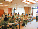
| 5. Continuing Professional
Development Center Activities |
The Association provides the following training courses to
educate and train survey technicians in order to enhance technology and
to develop the quality for survey technicians.
(1) Social correspondence course: The surveyor assistant authorized
by the Ministry of Education, Culture, Sports, Science and Technology is
held regularly.
(2) Survey expertise authorization: Authorization of the survey
expertise in control point survey, photogrammetry, application survey,
GIS,etc.
(3) School of surveying technologies: Survey expertise
seminar-for-qualifying and other various technical courses.
(4) Survey training courses: Training courses for those are trying to
become registered surveyors, assistant registered surveyors and land and
house investigators are provided to assist in acquiring these national
qualifications.
(5) Survey Academy: The Academy provides a GIS course, seminars for
executives and training courses as an ongoing education and training
system for self-development.
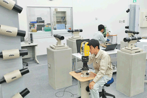
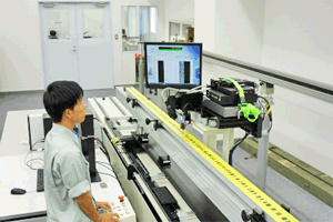
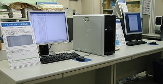
| 6. Surveying Technology Center
Activities |
The main services of the Surveying Technology Center are
calibration and examination of surveying instruments and survey data,
mapping out of survey implementation plans, analysis of survey results
and other consulting services. The Center also delivers the real-time
electronic control point data and provides other services.
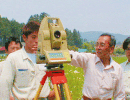
1) Calibration of surveying instruments Calibration certificates are
issued after precisely examining surveying instruments and other
equipments whether or not they have adequate performance to achieve to
achieve the required accuracy.
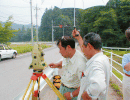
2) Official approval of control point results Examination
certificates are issued for survey results (data) by determining whether
or not surveys were conducted correctly in accordance with particular
specifications.
3) Official approval of map results Examinations are made whether or
not maps including numerical values were produced correctly in
accordance with specifications, and examination certificates are issued
to those maps and date that meet examination requirements. 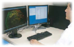
4) Official approval of a computer program Examinations of survey
calculation programs used in public surveys are made to examine whether
or not they meet the calculation standards specified in specifications.
Examination certificates are issued for programs that conform to the
specifications.
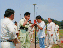
5) Survey consultant
(1) Implementation of various experiment
surveys, a preliminary surveys, a preliminary survey of an overseas
survey and the coordinates conversion of land survey result 2000.
(2) Construction of a plan and design of survey implementation and
various survey work regulations.
(3) Implementation of the precise
analysis of crustal deformation survey and various kinds of geographical
investigations.
6) Geodetic Surveying Data Service
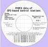
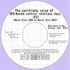
(1) By the distribution servise of the established GNSS-based control station
data, Real-time data of about 1,300 GNSS-based control stations throughout
Japan are delivered to position information service entrepreneurs.

7) Survey planning and managing Services are undertaken on commission the
clients of public survey works.
8) Proof of technologies developed by construction industries Survey
technologies developed and studied independently by the private sector
are examined, and examination certificates are issued.
COUNCIL OF JAS (as of June 24, 2025)
| President: |
Dr. SHIMIZU Eihan |
| Vice President: |
Mr. MURAKAMI Masaki |
| Director General: |
Mr. SUMITA Eiji |
| Secretary General: |
Mr. FUJITA Naoyuki |
| Director of Survey Technology Center: |
Mr. HIROTA Mitsunari |
| Japan Association of Surveyors |
5th floor Park Court Bunkyo Koishikawa,
1-5-1 Koishikawa,Bunkyou-ku,TOKYO,112-0002,JAPAN |
 to top
page to top
page
|